


Bons porte romaine

parastat
User
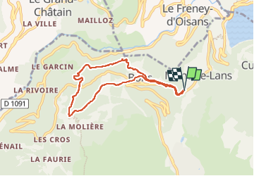

Length
6.9 km

Max alt
1429 m

Uphill gradient
381 m
Km-Effort
11.9 km

Min alt
1092 m

Downhill gradient
377 m
Boucle
Yes
Creation date :
2022-08-13 06:50:17.886
Updated on :
2022-08-13 14:25:45.465
2h40
Difficulty : Medium

FREE GPS app for hiking
 SityTrail
IGN / Geographical institutes
SityTrail Plus
The world is yours!
About
Trail Walking of 6.9 km to be discovered at Auvergne-Rhône-Alpes, Isère, Les Deux Alpes. This trail is proposed by parastat.
Description
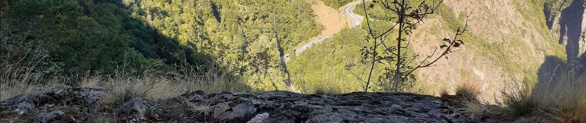
Entre Bons et la porte un peu de prudence avec de jeunes enfants.
Le parking à Mont de Lans ajoute un peu de route mais reste bien pratique.
Beaucoup de sous-bois: agréable par temps chaud
Photos


Positioning
Country:
France
Region :
Auvergne-Rhône-Alpes
Department/Province :
Isère
Municipality :
Les Deux Alpes
Location:
Unknown
Start:(Dec)
Start:(UTM)
273632 ; 4990614 (32T) N.
Comments